静岡県北部の南アルプスの地滑りデータベース / Landslide Database in the South Alps Area, Northern Shizuoka Prefecture
はじめに / Introduction
このページでは、独自に作成している地滑りマップ(KMZファイル)をパソコンで表示する方法を説明します。Google Earth Pro(デスクトップ版)を使います。
This page explains how to view the original landslide map (KMZ file) on your computer using Google Earth Pro (desktop version).
- 対応OS: Windows / Mac / Linux (スマホ・タブレットは対象外)
Supported OS: Windows / Mac / Linux (Smartphones and tablets are not supported.)
手順 / Steps
- Google Earth Proをインストール
Install Google Earth Pro - このサイトからKMZをダウンロード
Download the KMZ file from this website - KMZをGoogle Earth Proで開く
Open the KMZ file with Google Earth Pro
1. Google Earth Pro をインストール / Install Google Earth Pro
インストール方法はWindowsとMacで多少異なりますのでご自身のPCに合わせてお選びください。すでにGoogle Earth Proをインストール済みの方は手順2まで飛ばしてください。
Installation procedures differ slightly between Windows and Mac. If Google Earth Pro is already installed, please skip to Step 2.
Windows でのインストール方法 / For Windows
- お使いのパソコンで Google Earth Proを使用するには、最小システム要件をすべて満たしている必要があります。以下の要件を満たしているか確認してください。
To use Google Earth Pro on your computer, it must meet the following minimum system requirements.- 最小要件 / Minimum requirements:
- オペレーティング システム: Windows 7 / Operating System: Windows 7
- CPU: 1 GHz 以上 / CPU: 1 GHz or higher
- システムメモリ(RAM): 2 GB / RAM: 2 GB
- ハードディスク: 2 GB の空き容量 / Hard Disk: 2 GB free space
- インターネット接続 / Internet connection
- グラフィック プロセッサ: DirectX 9 互換または OpenGL 1.4 互換 / Graphics: DirectX 9-compatible or OpenGL 1.4-compatible
- 推奨要件 / Recommended requirements:
- オペレーティング システム: Windows 7 以上 / Operating System: Windows 7 or later
- CPU: 2 GHz デュアルコア以上 / CPU: Dual-core 2 GHz or higher
- システムメモリ(RAM): 4 GB / RAM: 4 GB
- ハードディスク: 4 GB の空き容量 / Hard Disk: 4 GB free space
- 高速インターネット接続 / High-speed Internet connection
- グラフィック プロセッサ: DirectX 11 互換または OpenGL 2.0 互換 / Graphics: DirectX 11-compatible or OpenGL 2.0-compatible
- 最小要件 / Minimum requirements:
- Google公式のページにアクセスしGoogle Earth Pro をダウンロードします。
Go to the official Google page and download Google Earth Pro.
https://www.google.com/earth/about/versions/#download-pro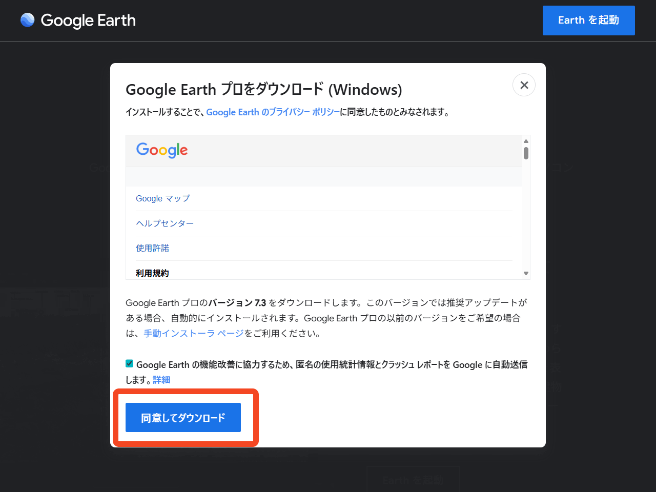
- ダウンロードした GoogleEarthProSetup.exe を実行するとインストールが実行されるので完了まで待ちます。
Run the downloaded file GoogleEarthProSetup.exe. Wait for the installation to complete.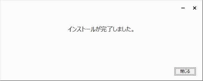
- デスクトップに追加された Google Earth Pro を起動してください。
Launch Google Earth Pro from your desktop.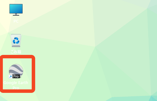
Mac でのインストール方法 / For Mac
- お使いのパソコンで Google Earth Proを使用するには、最小システム要件をすべて満たしている必要があります。以下の要件を満たしているか確認してください。
Before installing, check that your computer meets the following requirements.
※ Apple シリコン機では Rosetta 経由で動作します。
On Apple Silicon devices, Google Earth Pro runs via Rosetta.- 最小要件 / Minimum requirements:
- オペレーティング システム: Mac OS 10.8 / Operating System: macOS 10.8
- CPU: Intel 64 ビット / CPU: Intel 64-bit
- システムメモリ(RAM): 2 GB / RAM: 2 GB
- ハードディスク: 2 GB の空き容量 / Hard Disk: 2 GB free space
- インターネット接続 / Internet connection
- グラフィック プロセッサ: OpenGL 1.4 互換 / Graphics: OpenGL 1.4-compatible
- 推奨要件 / Recommended requirements:
- オペレーティング システム: Mac OS 10.8 以降 / Operating System: macOS 10.8 or later
- CPU: Intel デュアルコア 64 ビット / CPU: Intel dual-core 64-bit
- システムメモリ(RAM): 4 GB / RAM: 4 GB
- ハードディスク: 4 GB の空き容量 / Hard Disk: 4 GB free space
- 高速インターネット接続 / High-speed Internet connection
- グラフィック プロセッサ: OpenGL 2.0 互換 / Graphics: OpenGL 2.0-compatible
- 最小要件 / Minimum requirements:
- Google公式ページにアクセスしGoogle Earth Pro をダウンロードします。
Go to the official Google page and Google Earth Pro.
https://www.google.com/earth/about/versions/#download-pro
注: Appleシリコン機では初回起動時に Rosetta のインストールを求められる場合があるのでその場合はインストールをクリックしてください。
Note: On Apple Silicon devices, you may be prompted to install Rosetta the first time you launch the application. If this happens, please click Install.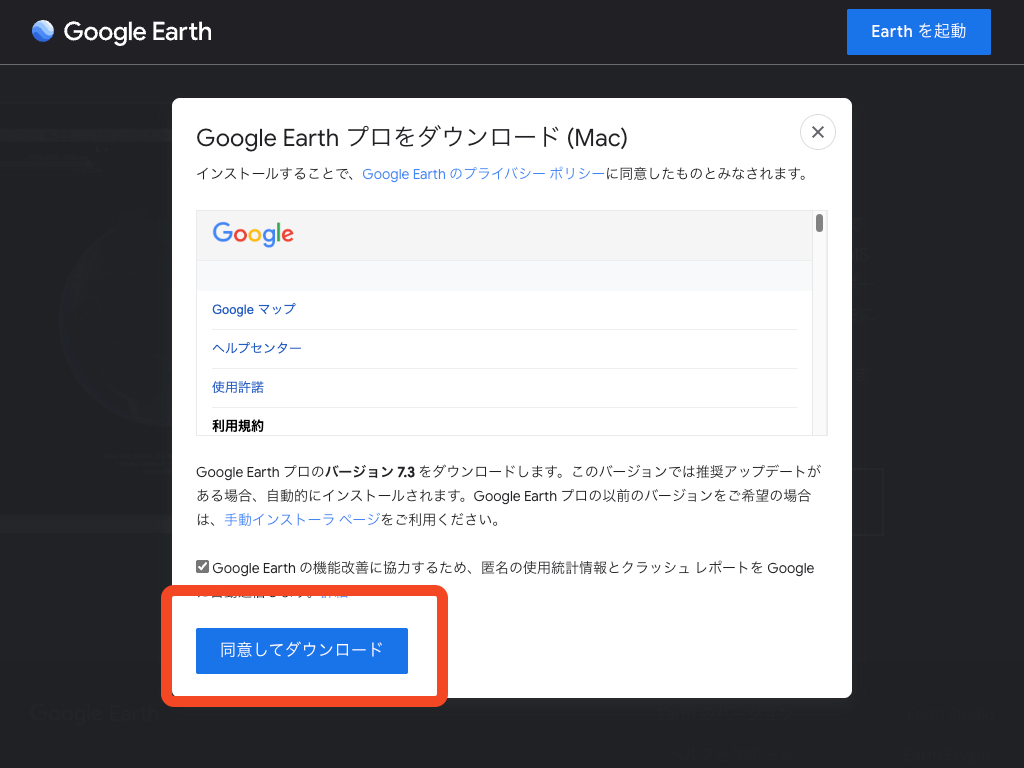
- Install Google Earth Pro.pkg を実行してインストールを開始します。以下のpkgをダブルクリック後に手順に従ってインストールを進めてください。
Run Install Google Earth Pro.pkg to begin the installation. Double-click the pkg file below and follow the on-screen instructions to complete the installation.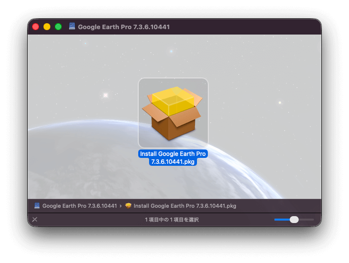
- 「アプリケーション」フォルダから Google Earth Pro を起動してください。
Launch Google Earth Pro from the Applications folder.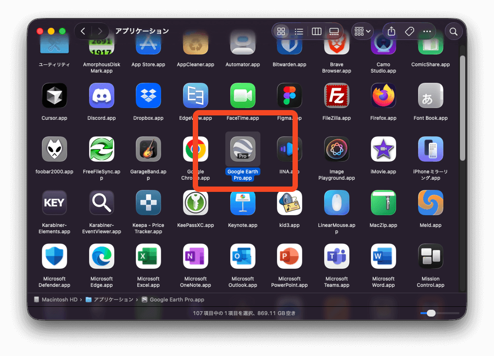
Linux でのインストール方法 / For Linux
- お使いのパソコンで Google Earth Proを使用するには、最小システム要件をすべて満たしている必要があります。以下の要件を満たしているか確認してください。
To use Google Earth Pro on your computer, it must meet all the minimum system requirements. Please check that your system meets the requirements listed below.- 最小要件 / Minimum requirements:
- オペレーティング システム: Ubuntu 14 / Fedora 23(または同等)以降 / Operating System: Ubuntu 14 / Fedora 23 (or equivalent) or later
- CPU: AMD64 互換、1 GHz / CPU: AMD64 compatible, 1 GHz
- システムメモリ(RAM): 2 GB / System Memory (RAM): 2 GB
- ハードディスク: 2 GB の空き容量 / Hard Disk: 2 GB of free space
- インターネット接続 / Internet Connection
- 3D グラフィックス サブシステム: OpenGL 1.4 互換 / 3D Graphics Subsystem: OpenGL 1.4 compatible
- 推奨要件 / Recommended Requirements:
- CPU: AMD64 互換、2 GHz / CPU: AMD64 compatible, 2 GHz
- システムメモリ(RAM): 4 GB / System Memory (RAM): 4 GB
- ハードディスク: 4 GB の空き容量 / Hard Disk: 4 GB of free space
- 高速インターネット接続 / High-speed Internet Connection
- 3D グラフィックス サブシステム: OpenGL 2.0 互換 / 3D Graphics Subsystem: OpenGL 2.0 compatible
- 画面: 解像度 1280×1024、32 ビットカラー / Display: 1280 × 1024 resolution, 32-bit color
- Google Earth Proは、Ubuntu と Fedora Linux の最新バージョンのディストリビューションで機能します。他の一般的なディストリビューションでも動作する可能性はありますが、Linux プラットフォームは多種多様であるため動作保証はされません。
Google Earth Pro works with recent versions of Ubuntu and Fedora Linux distributions. It may also run on other popular distributions, but because of the wide variety of Linux platforms, operation cannot be guaranteed.
- 最小要件 / Minimum requirements:
- Google公式のWEBサイトにアクセスし64bit .deb(Debian/Ubuntu向け)または64bit .rpm(Fedora/openSUSE向け)を選択し、利用規約に同意して Google Earth Pro をダウンロードします。
Go to the official Google website and then select 64-bit .deb (for Debian/Ubuntu) or 64-bit .rpm (for Fedora/openSUSE). Agree to the Terms of Service to download Google Earth Pro.
https://www.google.com/earth/about/versions/#download-pro - ダウンロードしたパッケージを、各ディストリビューションの標準的な方法(例:パッケージマネージャ/ソフトウェアセンター等)でインストールします。
Install the downloaded package using the standard method for your distribution (e.g., via the package manager or software center). - アプリケーションメニューから Google Earth Pro を起動します。
Launch Google Earth Pro from the Applications menu.
2. KMZファイルをダウンロード / Download the KMZ file
以下URLからKMZファイルをダウンロードしてください。
Please download the KMZ file from the URL below.
http://shizuoka-landslide-kmz.vercel.app/shizuoka-landslide-kmz.kmz
3. KMZファイルを Google Earth Pro で開く / Open the KMZ file in Google Earth Pro
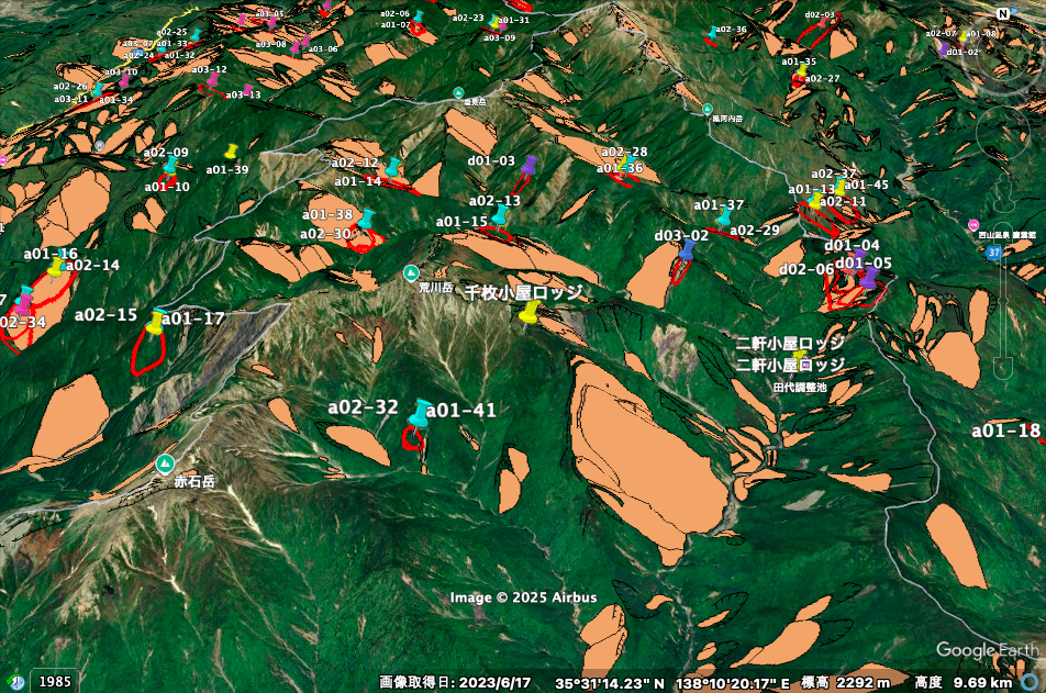
ダウンロードしたKMZファイルを開くと自動的に Google Earth Pro で読み込みされます。もしも開かない場合は「ファイル > 開く」などからKMZファイルを開いてください。表示されると下の様な画像が表示されます。
When you open the downloaded KMZ file, it will automatically be loaded in Google Earth Pro. If it does not open automatically, please open the KMZ file manually via “File > Open” or a similar option. Once loaded, you will see a display similar to the image below.
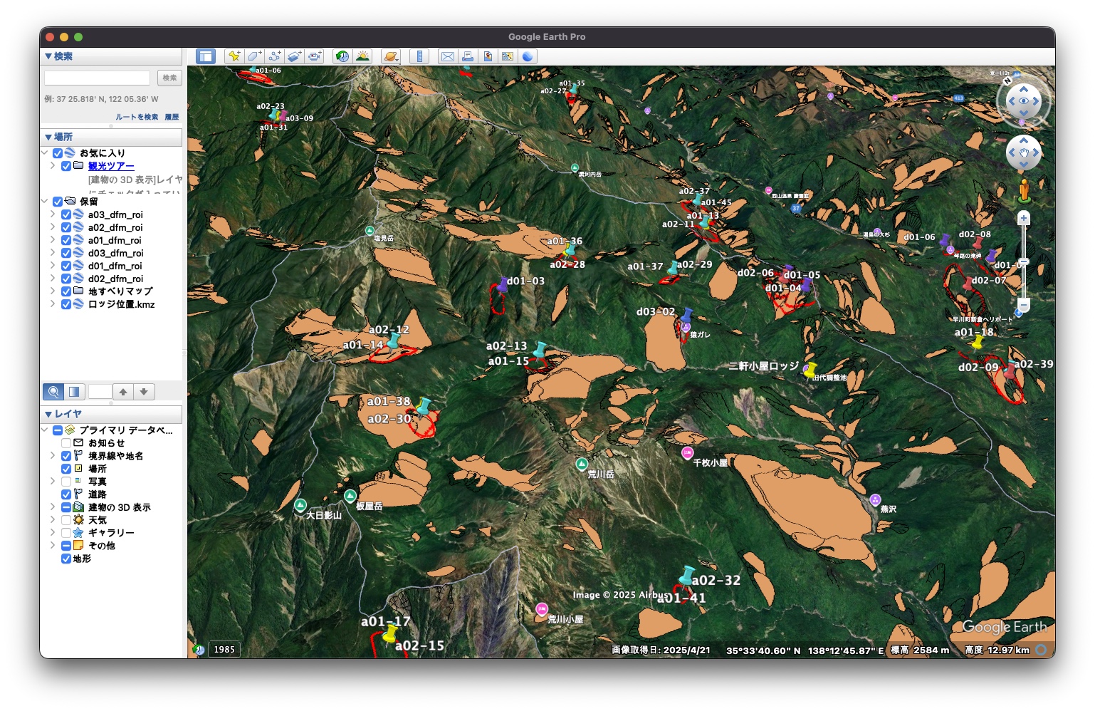
データの説明 / Data Description
- a#_dfm_roi|だいちの北行軌道※1)により地滑りと考えられる地形の特徴が見られた地域
Areas showing topographic features considered to be landslides, detected from DAICHI satellite’s ascending orbit observations※1)- #=01|2019年11月22日と2021年11月19日の観測に基づく
Based on observations on November 22, 2019 and November 19, 2021 - #=02|2019年11月22日と2022年12月2日の観測に基づく
Based on observations on November 22, 2019 and December 2, 2022 - #=03|2021年11月19日と2022年12月2日の観測に基づく
Based on observations on November 19, 2021 and December 2, 2022
- #=01|2019年11月22日と2021年11月19日の観測に基づく
- b#_dfm_roi|a#_dfm_roiと同じだが、南行軌道※1)による
Same as a#_dfm_roi, but detected from DAICHI satellite’s descending orbit observations※1)- #=01|2019年11月5日と2021年8月10日の観測に基づく
Based on observations on November 5, 2019 and August 10, 2021 - #=02|2019年11月5日と2023年2月21日の観測に基づく
Based on observations on November 5, 2019 and February 21, 2023 - #=03|2021年8月10日と2023年2月21日の観測に基づく
Based on observations on August 10, 2021 and February 21, 2023
- #=01|2019年11月5日と2021年8月10日の観測に基づく
- 地すべりマップ|防災科学技術研究所※2)によって判読された地すべりによる痕跡のあった地域
Areas identified as having traces of landslides, interpreted by the National Research Institute for Earth Science and Disaster Resilience (NIED)※2)
- ロッジの位置.kmz|椹島ロッジ、二軒小屋ロッジ、千枚小屋の位置
Locations of Sawarajima Lodge, Niken-goya Lodge, and Senmai-goya
1) だいちによるSARでは、衛星の進行方向に対して、右のななめ下方向(衛星視線方向)を観測しており、西側から観測する「北行軌道」と、東側から観測する「南行軌道」がある
The DAICHI (ALOS) satellite observes the ground obliquely to the right and downward relative to its flight direction. It has two observation modes: the ascending orbit, which observes from the west, and the descending orbit, which observes from the east.
2) https://www.j-shis.bosai.go.jp/landslidemap
謝辞 / Acknowledgements
本研究はROIS-DS-JOINT (008RP2025) 、南アルプス学会、Yahoo!基金 2023年度 防災減災活動支援助成プログラムから助成を受けました。
This work was supported by ROIS-DS-JOINT (008RP2025), Minami-Alps Society, and Yahoo! JAPAN Foundation FY2023 Disaster Risk Reduction Activity Support Grant Program.